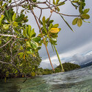
InVEST is a suite of software models used to map and value the goods and services from nature that sustain and fulfill human life. It aims to provide a consistent methodology for measuring and comparing the value of multiple ecosystem services underdifferent ecological conditions. The toolset currently includes sixteen distinct InVEST models suited to terrestrial, freshwater, and marine ecosystems. InVEST models are based on production functions that calculate the potential of ecosystems to provide human benefits, such as carbon sequestration, crop pollination, managed timber production, water purification, hydropower production, coastal protection, fisheries, and offshore wind energy. The models are spatially explicit, using maps as information sources and producing maps and summary metrics as outputs. The multi-service, modular design of InVEST provides an effective tool for comparing scenarios to balance environmental and economic needs. The tool is modular so that users can select only those environmental services of interest to model. InVEST models can be run independently, or as script tools in the ArcGIS ArcToolBox environment. A mapping software such as QGIS or ArcGIS is required to view the results.
Help build the LPS: Find out how to submit a case study and other ways to contribute.

